
Why this research?
Over the last three decades there have been changes in the way cities look around the world, including Glasgow. Governments, local authorities and institutions, such as museums, have adopted strategies to develop historic industrial and now-derelict areas in people’s neighborhoods for regeneration purposes. The aims for such changes are to make areas safer and more usable, to attract visitors and tourists and to create income. However, these changes have affected the image of these places, and to an extent they have changed the way people occupy them. Some of these places of the old industries are waterways, rivers and canals, such as the river Clyde and the Forth and Clyde canal, and they run through neighborhoods, the locality where people live, work and spend their time. The city changes fast around the these waterways, and these changes affect everyone and everything in the locality.
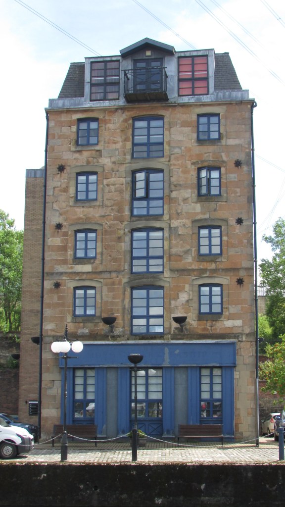
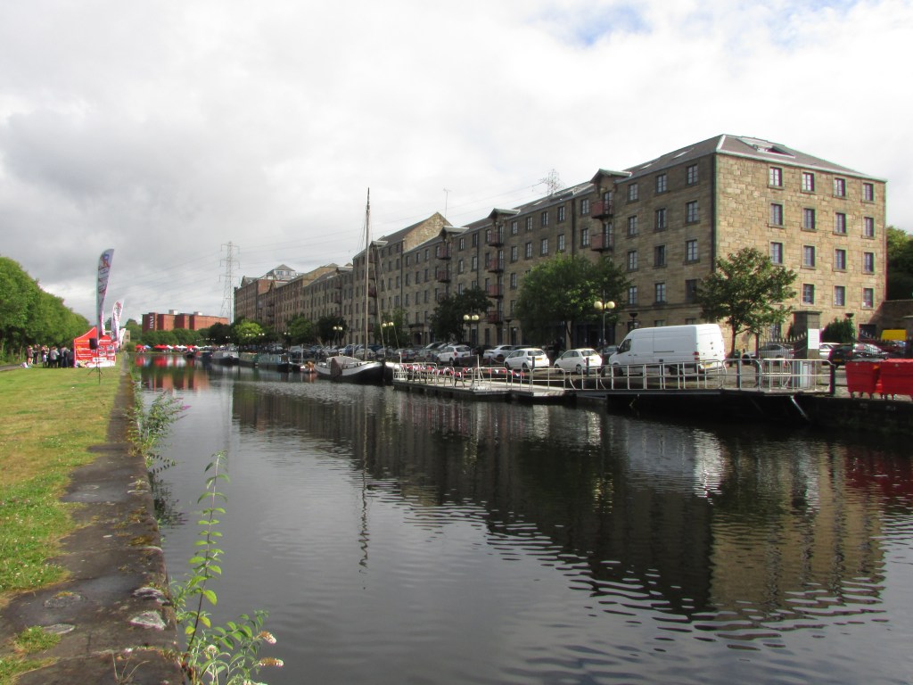
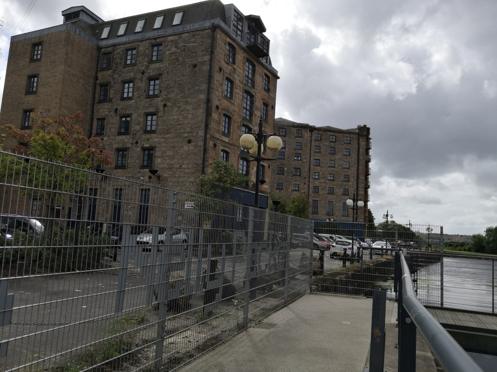
Photographs: Speirs Wharf, Maryhill, on the Forth and Clyde canal used to be the part of the canal where goods were carried to the river to be shipped around Scotland and the world. Today, the old industrial buildings have been converted into luxury flats and the area has been developed as the 'cultural quarter' of Glasgow, with art organisations making the area their home, and businesses such as cafes, leisure centers and restaurants have completed the character of the new place. Photo credit: CanalCraft Participant.
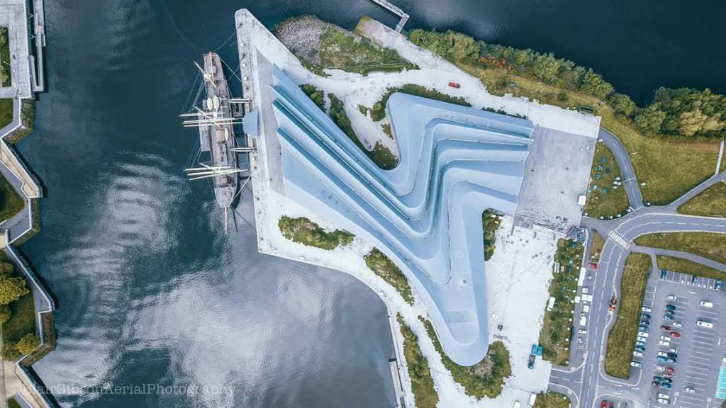
Photograph: The Riverside development. Since 2011, when the Riverside museum opened to the public, the area around it has been developed as public space. The Tall Ship (Glenlee) is moored in front of the museum. The Riverside museum building is an inspirational building, a landmark for Glasgow, and a reminder of the city's glorious shipbuilding past. Credit: CMT
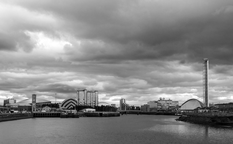
Glasgow landscape looking from the Riverside. Other iconic buildings, such as the Science Centre with its tower and the Hydro belong to the river Clyde regeneration process of creating a metropolitan city. Credit: I Maclellan
So, this research aimed to find out the ways people in their locality engage with the heritage of the Forth and Clyde canal and the river Clyde, in their neighborhoods. The research also wanted to examine how ways of connecting and interacting with heritage were helpful in the understanding of the historic environment and its meaning to people. In order to achieve this, the researcher worked together with community groups in two different localities on the canal, Maryhill and Kirkintilloch, in activities on and around the water, and interviewed people who worked for cultural organisations on the river Clyde.
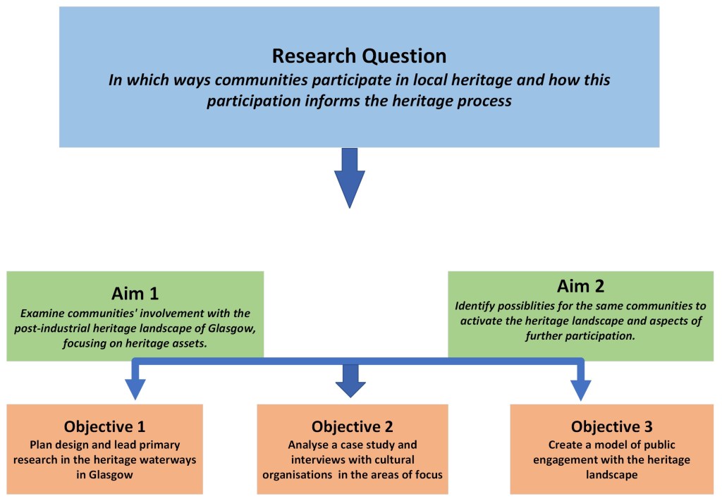
This diagram explains briefly the beginning of the research journey. I started by setting myself the question of how communities in the locality of the river Clyde and the Forth and Clyde canal participate in the heritage. In order to answer this question I had to find out if and how communities were involved with their locality's heritage, such as canal boats, museums, and historic buildings such as bridges. I also had to find out ways for the same communities to interact with the landscape, and specifically the water of the river and the canal. These aims could be achieved through planning and leading a study, which will allow me to analyse the results of a case study and to ask people directly about their activities. Finally, I set out to create a model for communities and others interested in participation to use for interacting with their locality.
